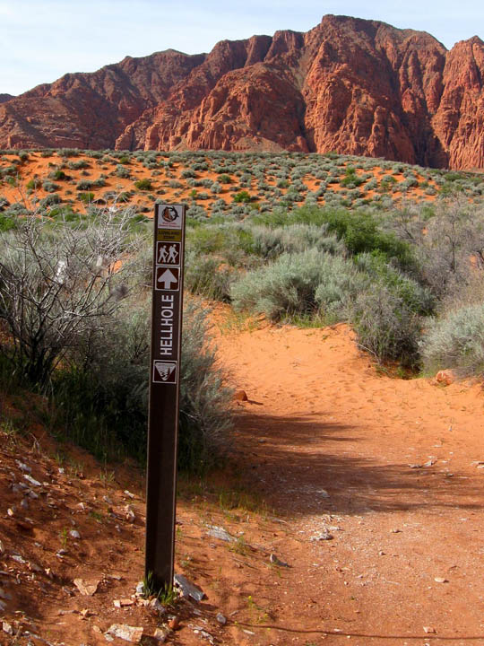


Hellhole Trail
Length: 4.5 miles roundtrip
Trail: Soft sand and rocks along an unnamed wash
Hiking Time: Average 3-4 hours (although it took me just around 2 hours)
Difficultly: Moderate
Area: Red Cliffs National Conservation Area
Sub Area: Red Mountain, Kayenta (Ivins)
Directions:
The trek begins at an unmarked trailhead that can be found on 400 West about 1 mile past the Kayenta welcome sign just outside of Ivins, which is located on the north side of Saint George, Utah. At the 1-mile mark you will come upon the first major wash along the black-topped route. Park on the south side of the road near another Kayenta sign where there is room for perhaps 2 or 3 vehicles.

2 comments:
I have done this hike before. It was an interesting hike. The bad thing was that last time I did this was in the middle of the summer and it held up to its name.
John
Yeah I heard this hike can be pretty unbearable in the summer. It was pretty nice this time of year though. I'd probably go a bit earlier in the day next time, and spend some time exploring in the back of the canyon.
Post a Comment