MENU

Showing posts with label desert. Show all posts

Sunday, May 22, 2011

Kanarra Creek Slot Canyon


Kanarra Creek Trail

Length: 3.5 miles to 1st waterfall, 3.7 miles to 2nd waterfall, 4.4 miles to turnaround.

Hiking Time: 4 hours Assent: +700' Trail: River hiking (Criss cross Kanarra Creek several times)

Equipment: Sturdy, sticky river hiking shoes and quick dry clothing. Dry bag for food, water, first aid kit and rope might be needed.

Difficulty: Moderate to Strenuous

Area: Just outside Kolob Canyon

Trailhead: Kanarraville (see below)

Sunday, April 17, 2011

Fisher Towers Trail - Moab (4.4 miles)


Fisher Towers Trail

Length: 2.2 miles to trail end (4.4 miles roundtrip)

Hiking Time: 3-4 hours

Assent: +650'

Trail: Constructed trail

Equipment: Sturdy, well-fitting hiking shoes, water.

Difficulty: Moderate

Sun Exposure: Full Sun

Area: Moab, Utah (near Arches NP)

Trailhead: Off Utah Scenic Byway 128. At 21 miles east of the Utah 128/US 191 junction, turn right and go 2.2 miles on an improved dirt road to a parking lot.


Map to the Fisher Towers Trailhead

View Larger Map

Corona Arch Trail - Moab (3 miles)


Corona Arch Trail

Length: 3 miles roundtrip

Hiking Time: 1.5 hours

Trail: Constructed trail and slickrock. Hiking-only trail.

Equipment: Sturdy, well-fitting hiking shoes, water.

Difficulty: Moderate

Sun Exposure: Full Sun

Area: Moab, Utah (near Arches NP)

Trailhead: On Utah Scenic Byway 279, 10 miles west of the Utah 279/U.S. 191 junction.


Map of the Corona Arch Trailhead

View Corona Arch Trailhead in a larger map

Saturday, April 16, 2011

Park Avenue Trail - Arches (2 miles)


Park Avenue - Arches National Park

Length: 1 mile (one way), 2 miles roundtrip

Hiking Time: 30-45 mins

Trail: Well maintained trail through towering Sandstone formations

Difficulty: Easy

Sun Exposure: Full Sun, Bring Plenty of water

Area: Arches, Moab, UT

Trailhead: Park Avenue parking area

Wednesday, April 13, 2011

Cinder Cone Trail (1.5 miles)


Cinder Cone Trail

Length: 1.5 miles roundtrip

Assent: +500'

Trail: Bare lava rock

Trailhead: The trailhead is on the right (east) side of the road as visitors drive up the canyon, one mile north of the Snow Canyon Drive junction with State Route 18.

Hiking Time: 1 hour

Difficulty: Strenuous

Area: Washington County, near Snow Canyon

Trailhead: The trailhead is on the right (east) side of the road as visitors drive up the canyon, one mile north of the Snow Canyon Drive junction with State Route 18.


Map of the Cinder Cone Trailhead

View Cinder Cone Trailhead in a larger map

Monday, April 4, 2011

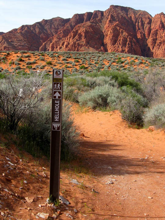
Hellhole Trail - Kayenta (4.5 miles)


Hellhole Trail

Length: 4.5 miles roundtrip

Trail: Soft sand and rocks along an unnamed wash

Hiking Time: Average 3-4 hours (although it took me just around 2 hours)

Difficultly: Moderate

Area: Red Cliffs National Conservation Area
Sub Area: Red Mountain, Kayenta (Ivins)

Directions:
The trek begins at an unmarked trailhead that can be found on 400 West about 1 mile past the Kayenta welcome sign just outside of Ivins, which is located on the north side of Saint George, Utah. At the 1-mile mark you will come upon the first major wash along the black-topped route. Park on the south side of the road near another Kayenta sign where there is room for perhaps 2 or 3 vehicles.

View Red Mountain Trail Map

Saturday, February 12, 2011

South Coyote Buttes - Paria Canyon/Vermillion Cliffs


South Coyote Buttes

Length: The milage will vary depending on how far you want to explore.

Average Hiking Time: 4 hours

Difficulty: Moderate

Trail: 4WD required to get to the South Coyote Buttes trailheads. Be aware of the clay and sand content of the road. It is impassable and dangerously slippery if wet.

Trailhead: Lone Tree Reservoir off House Rock Road or Paw Hole

Permits: Required BLM Coyote Buttes Permits

Area: Paria Canyon Wilderness Area - Vermillion Cliffs National Monument